May 1981 Flood
A series of extensive rainstorms during the month of May culminated in record flooding in west-central Montana during May 22-23, 1981. Precipitation amounts for the first half of May, which were generally well above average at most rainfall recording stations in the area, saturated the ground and raised streamflow levels to near-bankfull stages.
The larger storms of May 21-22 then combined with snowmelt to produce the destructive flooding that followed. The flooding was generally centered near Helena and affected both sides of the Continental Divide.
President Reagan declared 10 Montana counties a disaster area.
The focus here is on Helena-area flooding, and is limited to a selection of photographs and newspaper clippings. For the official USGS
report on the flood, please take this link (PDF file).
All photos, unless otherwise noted, are from Darla Sautter, courtesy of April Fife. |

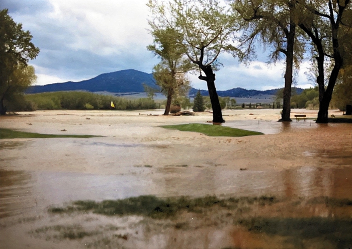
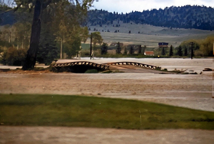
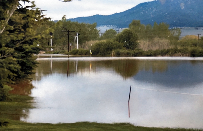
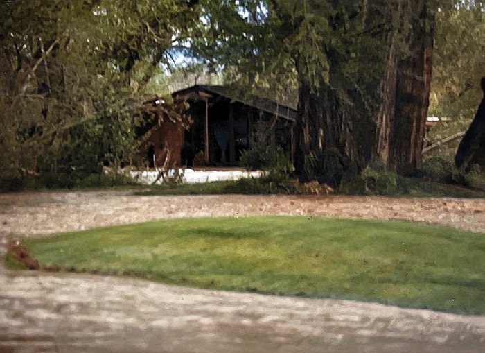
Green Meadow Country Club
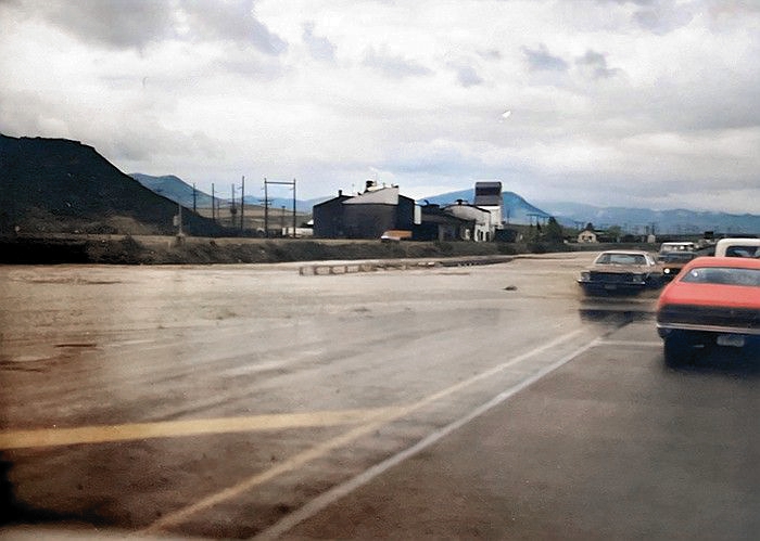
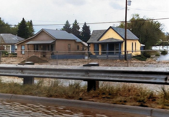
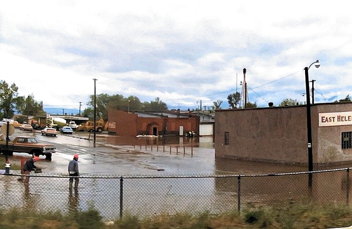
East Helena
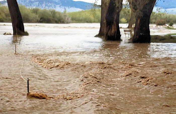
Prickly Pear Creek overflowing
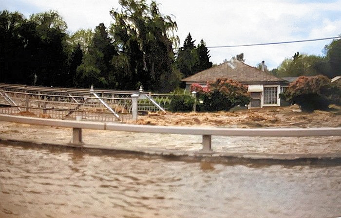
The flood destroyed the 1897 Pacific Street bridge. It was never replaced, although there was talk in 2006 that the 1894 Williams Street bridge, near the Broadwater Hotel site, would be installed on Pacific Street, after it was removed to make way for construction of the new Williams Street bridge. That did not come to pass.
The Pacific Street bridge was built in 1897, by the Missouri Valley Bridge and Iron Co. of Leavenworth, Kansas (Thanks to Jon Axline for this information). |
Houses on Pacific Street, east of the bridge.
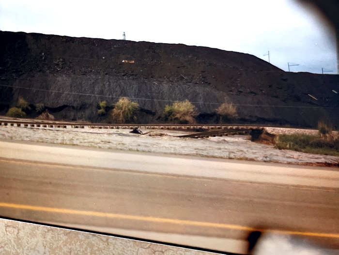
| Railroad bridge over Prickly Pear Creek washed out. This is the north side of the ASARCO slag heap. |
| Looking north on Morton Avenue. The East Helena Volunteer Fireman's Hall is on the right. |
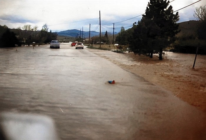
Looking south on Montana Ave., East Helena
Montana Highway 518 South of East Helena
Sidewalk Inscription
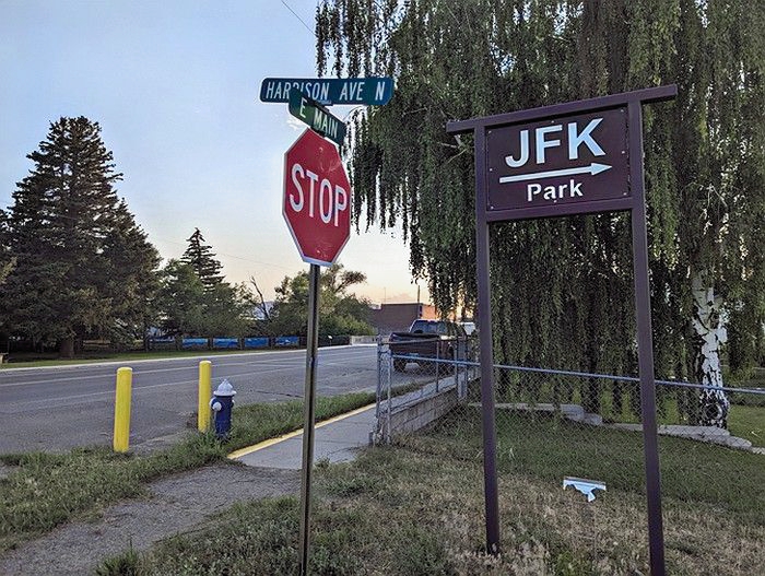
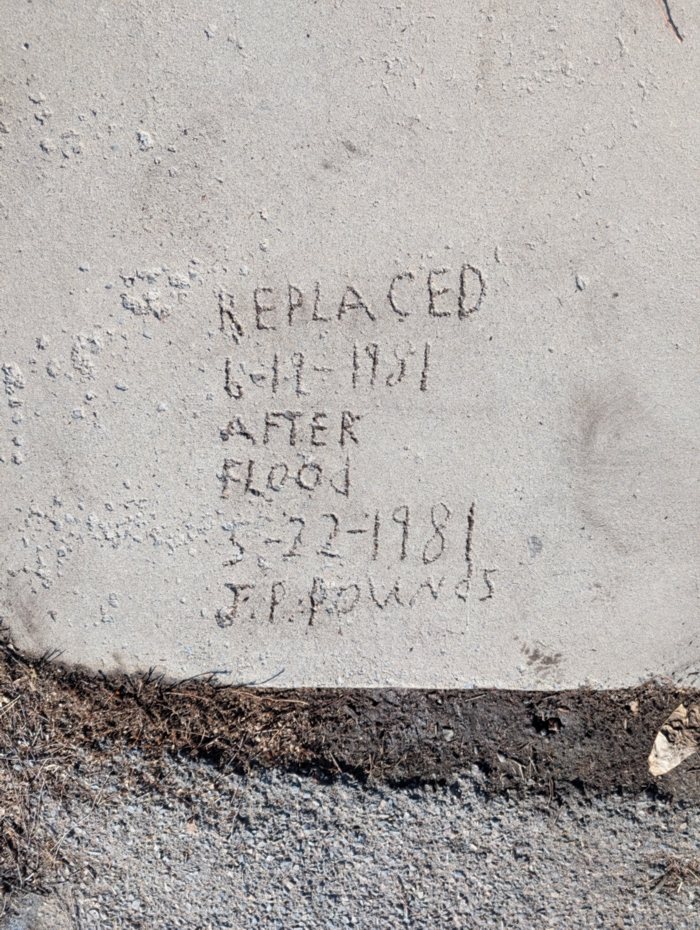
Joseph Phillip Pounds (1925-1998) added this commemorative inscription to wet concrete when the sidewalk at E. Main and Harrison Ave. was replaced in June of 1981.
Many thanks to Mardi Slocum for documenting this interesting artifact. |
Helena Valley
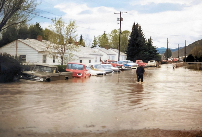
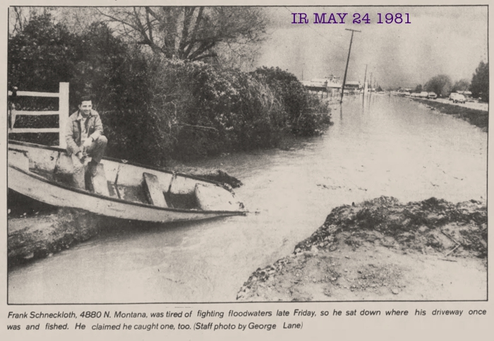
| Looking west on Myrl Road from the 5300 block of N. Montana Ave. |
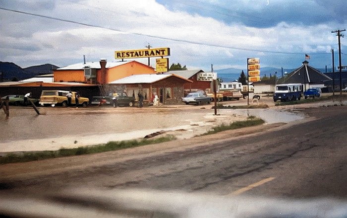
| Restaurant at 4960 N. Montana Ave. I think it was Cutone's at that time. On the right can be seen the flag-topped White Mill roadhouse, which opened about 1935. |
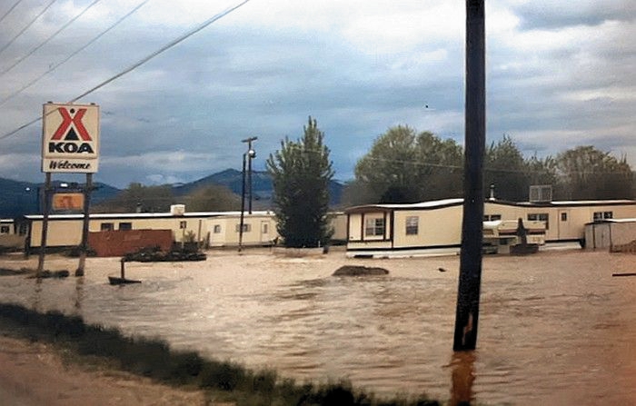
KOA campground, N. Montana Avenue

McHugh Lane at Mill Road
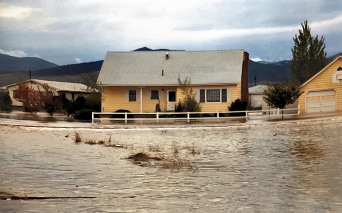
Flooded Valley Home
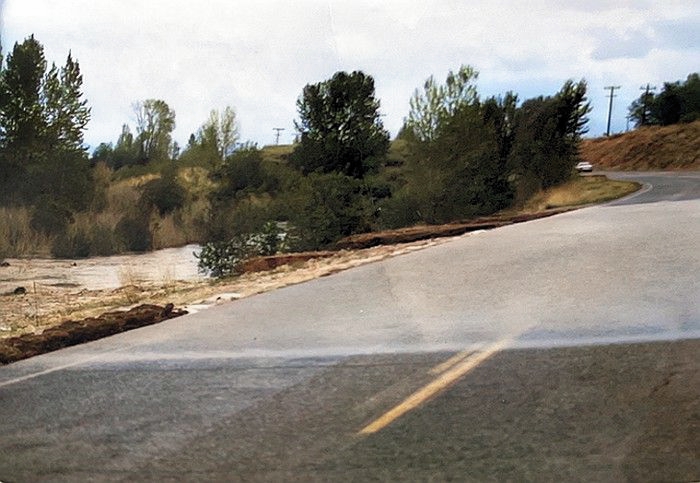
Clancy Area
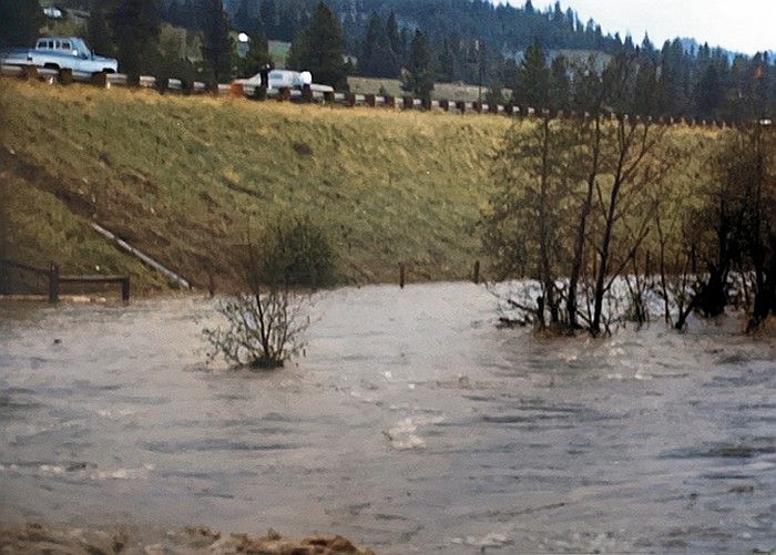
Prickly Pear Creek in flood beside I-15
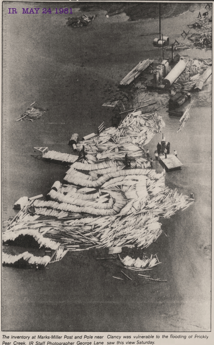
Marks-Miller Post and Pole awash


Pulling a Car Up the Embankment


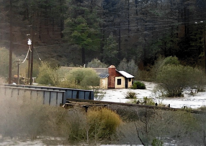


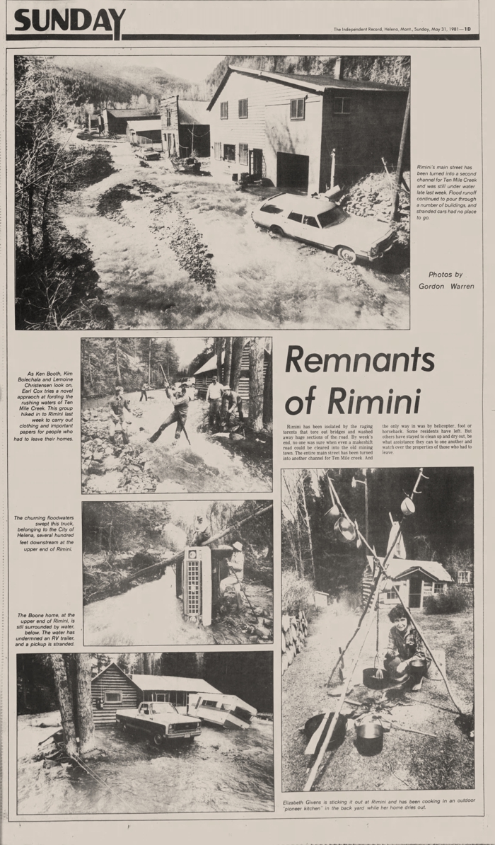
Rimini
Click on Image to Enlarge in a New Window


